Blog · January 9, 2019
Do You Live in a Flood Evacuation Zone? New Sea Grant Story Map Helps Connecticut Residents Find Out and Prepare for Coastal Storms
By Jennifer Marlon
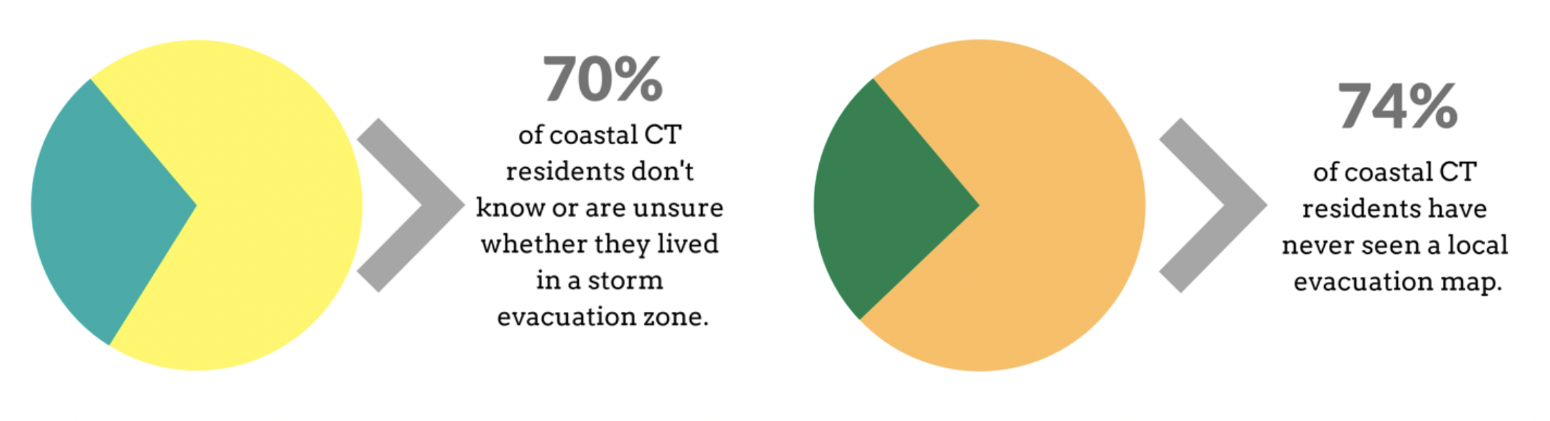
- 70% of coastal residents don’t know or are unsure about whether their home is in an evacuation zone
- 74% of coastal residents have never seen a local evacuation map
- 21% said they would evacuate for a Category 2 hurricane if they did NOT receive an official notice
- 34% of coastal residents believe it would be safer to remain at home during a Category 2 hurricane
- 52% say damage from past storms was more than they expected
Part of the reason residents have limited knowledge of evacuation routes is that local emergency managers are reluctant to put them on paper. Each storm is unique, and so evacuation routes for a given storm may depend on its type and direction. However, all residents should have awareness about roads near their homes that are likely to flood in a severe storm. In addition, evacuation zones, which differ from flood zones, are well established and every coastal resident should know whether they reside in one, or not.
To address these gaps in knowledge, the Connecticut Sea Grant Program [1] developed an interactive story map on coastal storm preparedness to help residents better understand their own risks. Any address in Connecticut can be searched in the interactive map in order to determine whether a home is located in an evacuation zone. The online tool also includes several preparedness resources for the entire coast and evacuation routes for four pilot towns.
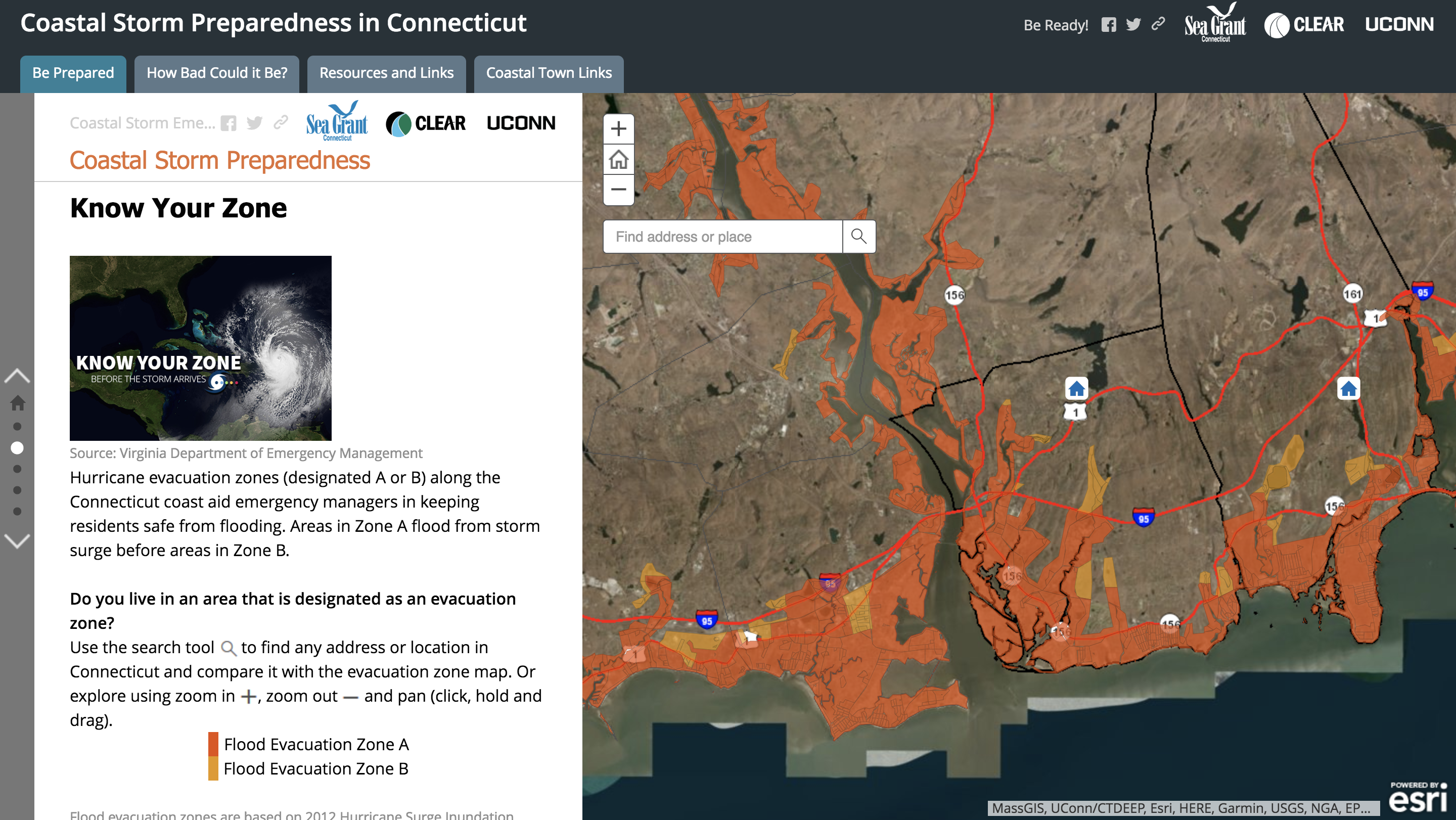
To use the story map, enter a specific address or zoom into an area to identify whether a home or workplace falls into a flood evacuation zone.
The tool also includes storm surge zones and identifies the category of hurricane that would cause inundation in that area. Users are urged to determine whether common roads, workplaces, or main highways are at risk to fully understand the scope of possible damage from a given hurricane or storm event.
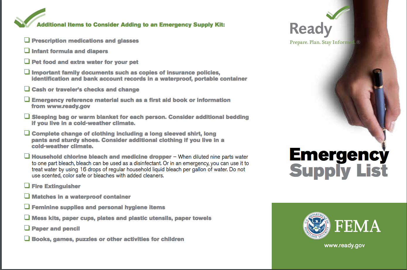
The story map uses four pilot towns—East Lyme, Madison, Old Lyme, and Stonington— to show mapped evacuation routes, links to join town-level emergency alert systems, and town-level respite or evacuation centers. It also has general resources including a check list of basic emergency supplies, pre-hurricane property preparation, and information on pet safety.
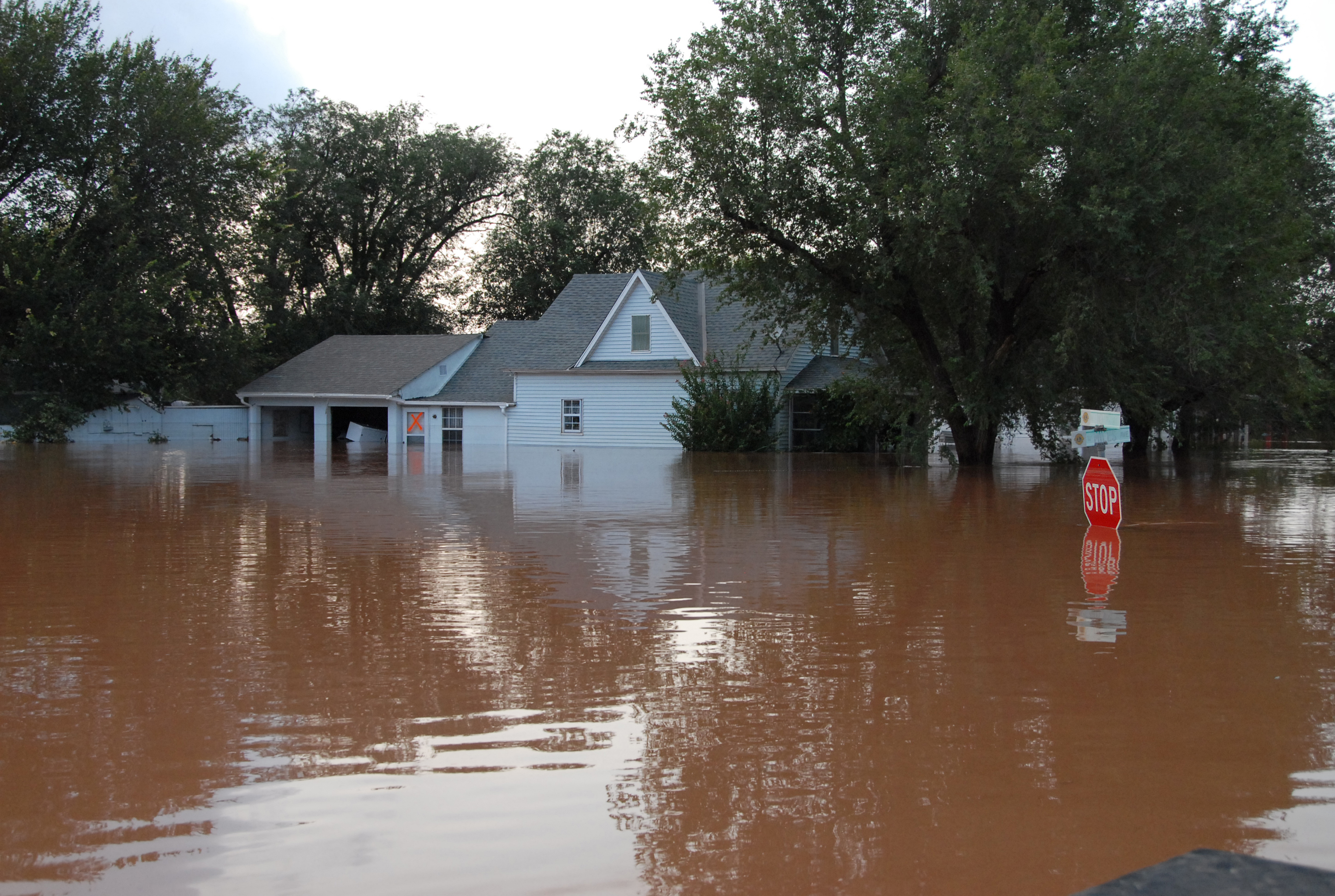
In addition to preparation for future storms, the story map gives users the chance to remember or learn about the impacts on Connecticut from the devastating Hurricane of 1938, or the “Long Island Express” as it came to be known. The pictures of flooded streets, post-storm wreckage photos, and recollections from survivors vividly show the potential devastation and risks posed by such storms, and more critically, underline the importance of preparation.
The Coastal Storm Preparedness in Connecticut Story Map can be found at: http://s.uconn.edu/coastalstormpreparedness.
[1] The Connecticut Sea Grant Program, located at the University of Connecticut Avery Point campus, is a state and federal partnership through the UConn and the National Oceanic and Atmospheric Administration’s National Sea Grant College Program.